_and_Serbian_(Baranja)_border.jpg)
_and_Serbian_(Baranja)_border.jpg&action=edit&redlink=1)
_and_Serbian_(Baranja)_border.jpg&action=edit)
_and_Serbian_(Baranja)_border.jpg&action=history)
File:Liberland - Croatian (Backa) and Serbian (Baranja) border.jpg
From Kook Science
Size of this preview: 600 × 600 pixels. Other resolution: 1,520 × 1,520 pixels.
Original file (1,520 × 1,520 pixels, file size: 261 KB, MIME type: image/jpeg)
Summary
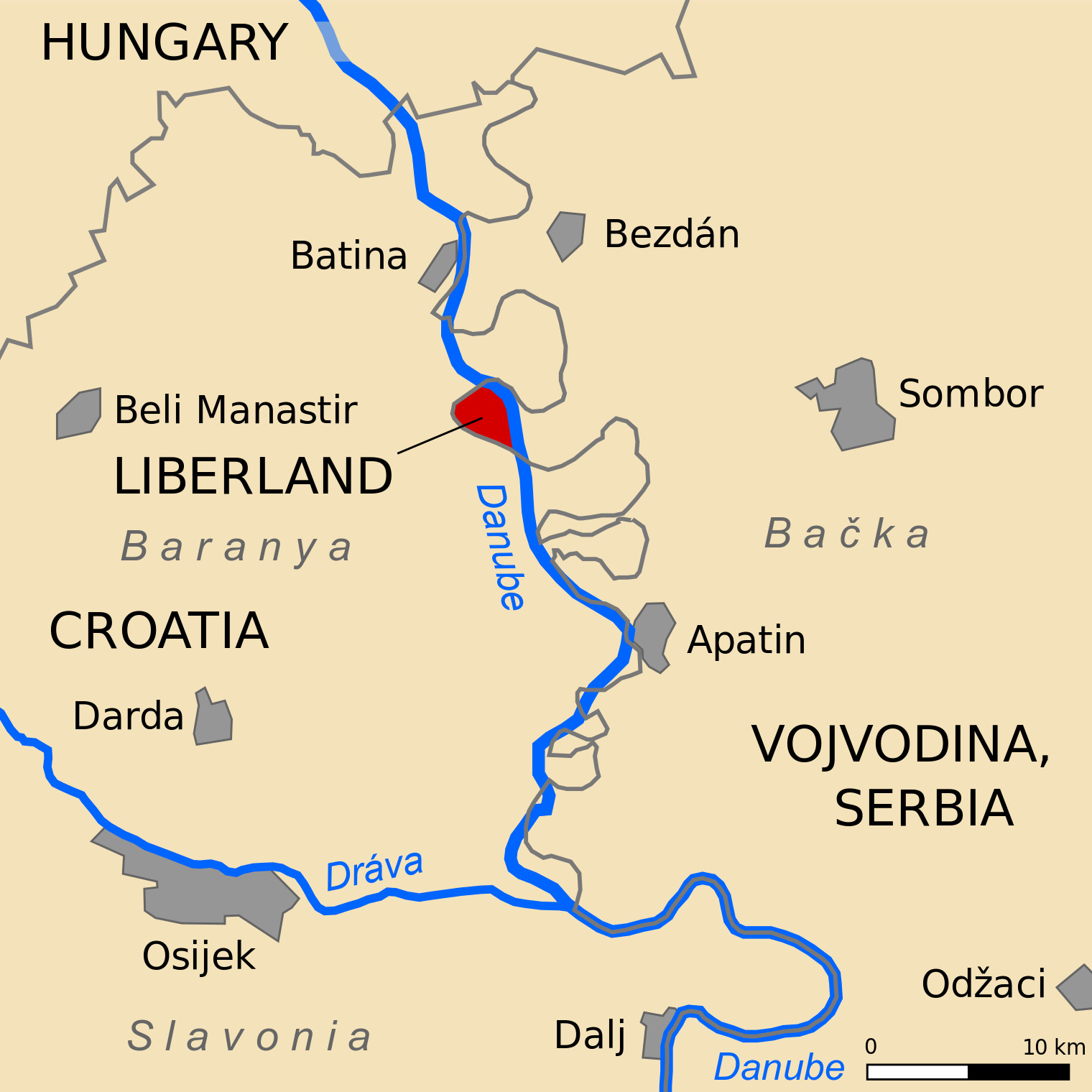
Description: Free Republic of Liberland location on a map by Tomobe03.
Source: https://commons.wikimedia.org/wiki/File:Croatia_Serbia_border_Backa_Baranja-hun.svg
Author: https://commons.wikimedia.org/wiki/User:Tomobe03
Licensing
| This work is licensed under the Creative Commons Attribution-ShareAlike 3.0 License. |
File history
Click on a date/time to view the file as it appeared at that time.
| Date/Time | Thumbnail | Dimensions | User | Comment | |
|---|---|---|---|---|---|
| current | 11:00, 2 April 2022 | | 1,520 × 1,520 (261 KB) | TK (talk | contribs) | Description: Free Republic of Liberland location on a map by Tomobe03.<br> Source: https://commons.wikimedia.org/wiki/File:Croatia_Serbia_border_Backa_Baranja-hun.svg<br> Author: https://commons.wikimedia.org/wiki/User:Tomobe03<br> |
You cannot overwrite this file.
File usage
The following page uses this file:
_and_Serbian_(Baranja)_border.jpg&oldid=24095)