.jpg)
.jpg&action=edit&redlink=1)
.jpg&action=edit)
.jpg&action=history)
File:Gleason's New Standard Map of the World (1892).jpg
From Kook Science
Size of this preview: 421 × 599 pixels. Other resolutions: 1,439 × 2,048 pixels | 4,773 × 6,794 pixels.
Original file (4,773 × 6,794 pixels, file size: 7.3 MB, MIME type: image/jpeg)
Summary
| Description |
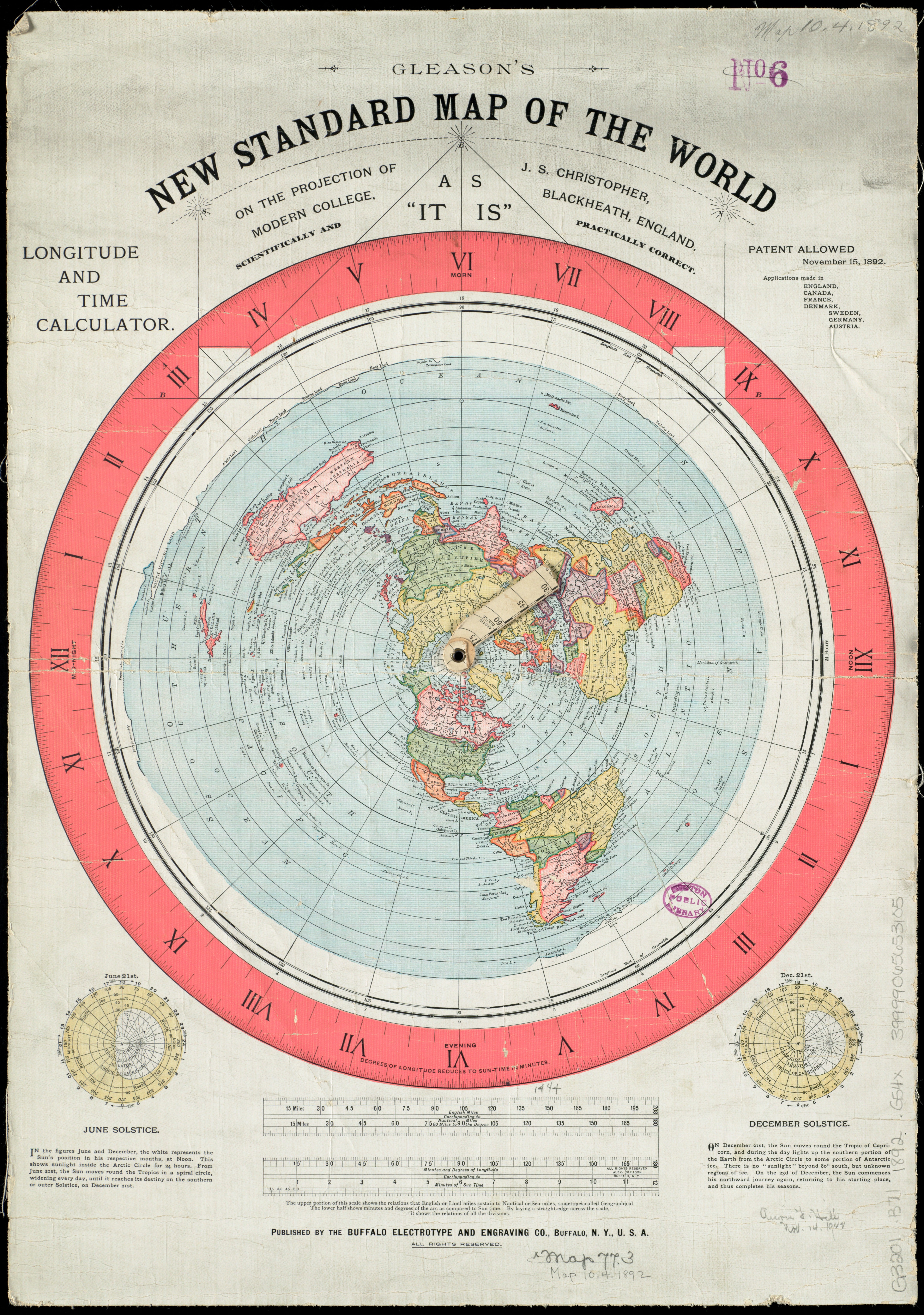
(Alexander) Gleason's New Standard Map of the World: on the projection of J. S. Christopher, Modern College, Blackheath, England; scientifically and practically correct; as "it is." [Map of the globe stretched and flattened into a circular plane. Includes longitude and time calculator and diagrams showing June and December solstices.] |
|---|---|
| Source | |
| Date |
1892 |
| Author |
Alexander Gleason, Buffalo Electrotype and Engraving Co. |
| Permission |
No known copyright restrictions. |
Licensing
| This work is licensed under the Creative Commons Attribution-ShareAlike 3.0 License. |
File history
Click on a date/time to view the file as it appeared at that time.
| Date/Time | Thumbnail | Dimensions | User | Comment | |
|---|---|---|---|---|---|
| current | 09:28, 27 September 2017 | | 4,773 × 6,794 (7.3 MB) | TK (talk | contribs) | {{Information |Description=(Alexander) Gleason's New Standard Map of the World: on the projection of J. S. Christopher, Modern College, Blackheath, England; scientifically and practically correct; as "it is." [Map of the globe str... |
You cannot overwrite this file.
File usage
The following 3 pages use this file:
.jpg&oldid=7679)